


Hot Products
0102030405

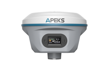
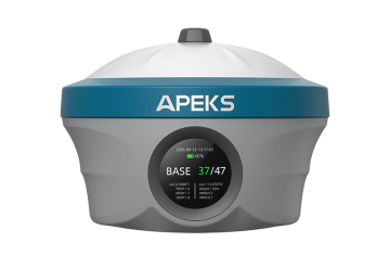
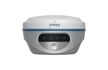
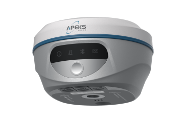
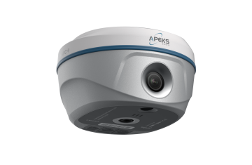
AP20 GNSS Receiver from China - Quality Solutions by Trusted Suppliers and Factory for Accurate Positioning
Satellites Tracking
| Channels | 1408 |
| GPS | L1C/A, L2C, L2P(Y), L5 |
| GLONASS | L1, L2, L3* |
| Galileo | E1, E5a, E5b, E6 |
| BDS | B1I, B2I, B3I, B1C, B2a, B2b* |
| QZSS | L1C/A, L1C, L2C, L5 |
| NavIC/IRNSS | L5 |
| SBAS | L1, L5* |
| L-Band | B2B-PPP & E6-HAS |
Accuracy
| Real Time Kinematics (RTK) |
H: 8 mm + 1 ppm RMS | V: 15 mm + 1 ppm RMS Initialization time: < 5s (typical) Initialization reliability: > 99.9% |
| Post-Processing Kinematics (PPK) | H: 2.5 mm + 0.5 ppm RMS | V: 5 mm + 0.5 ppm RMS |
| PPP | H: 10 cm RMS | V: 20 cm RMS |
| DGPS | H: 0.4 m RMS | V: 0.8 m RMS |
| Single Point | H: 1.5 m RMS | V: 2.5 m RMS |
| Position Frequency | 1Hz, 2Hz, 5Hz, 10Hz, 20Hz, 50Hz |
| Time to First Fix |
Cold start: < 45s Hot start: < 10s Signal re-acquisition: < 1s |
| IMU Tilt Angle | 0 – 120° |
| IMU Tilt Survey Accuracy | ≤ 2cm within 60° tilt angle |
Communication & Data
| UHF Radio | 2W Tx/Rx, 410-470 MHz Working range: 8-15 km in ideal environments |
| Protocol | TT450, TRIMMARK3, SOUTH, LORA Link rate: 9600 bps to 19200 bps |
| Wi-Fi | 802.11b/g/n/ac (Hotspot / Data Link) |
| Bluetooth | Bluetooth 5.2 classical / BLE proprietary dual-mode |
| NFC | NFC touch pairing |
| WebUI | Accessible via Wi-Fi |
| 4G Cellular | Integrated full-frequency multi-band 4G modem Supports LTE-TDD / LTE-FDD / WCDMA / CDMA2000 / UMTS / HSPA+ / GSM / GPRS / EDGE |
| I/O Ports |
• 1x USB Type-C port (Data download / Charging) • 1x Antenna port (UHF antenna interface) • 1x SIM card slot (Supports Nano-SIM) • 1x 5-pin Lemo port (RS-232) |
| Data Formats | RTCM 2.X, RTCM 3.X, RINEX, NMEA 0183 output, VRS, NTRIP |
| Data Storage | 32GB high-speed memory |
Hardware & Operational Specs
Battery & Power
Internal Li-ion 7.4V 7000mAh
USB Type-C Fast Charging
USB Type-C Fast Charging
Operation Time
Rover Mode: 18 hours
Base Mode: 7 hours
Static Mode: 20 hours
Base Mode: 7 hours
Static Mode: 20 hours
Dimensions & Weight
125mm (W) × 88mm (H) [4.92" × 3.46"]
Weight: 800g (1.76 lbs)
Weight: 800g (1.76 lbs)
Display & Interface
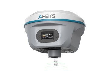
0.96'' OLED color screen
2 LED lights, 2 physical buttons
2 LED lights, 2 physical buttons
Operating Temperature
Working: -45°C to +75°C
Storage: -55°C to +85°C
Storage: -55°C to +85°C
Environmental Durability
IP67 Waterproof & Dustproof
IK08 Vibration | 2m Pole-Drop
IK08 Vibration | 2m Pole-Drop
Frequently Asked Questions
How many channels does this GNSS receiver support?
The device features 1408 channels capable of tracking all major satellite constellations, including GPS, GLONASS, Galileo, BDS, QZSS, NavIC/IRNSS, SBAS, and L-Band correction services.
What is the tilt compensation performance of the IMU?
The receiver supports an IMU tilt angle ranging from 0° to 120° and delivers high surveying accuracy of ≤2cm within a 60° tilt angle.
What is the typical battery life under different modes?
Powered by an internal 7.4V 7000mAh battery with Type-C fast charging, it delivers up to 18 hours of operation in Rover mode, 7 hours in Base mode, and 20 hours in Static mode.
What is the communication range of the internal UHF radio?
The integrated 2W Tx/Rx UHF radio operates across the 410-470 MHz frequency band and achieves a working distance of 8 to 15 km in ideal environmental conditions.
What level of environmental protection does this device offer?
The unit is rated IP67 for water and dust resistance, complies with IK08 vibration standards, operates in temperatures from -45°C to +75°C, and can survive a 2-meter drop onto concrete from a survey pole.