

What Is an RTK Machine? RTK Surveying Machines Explained
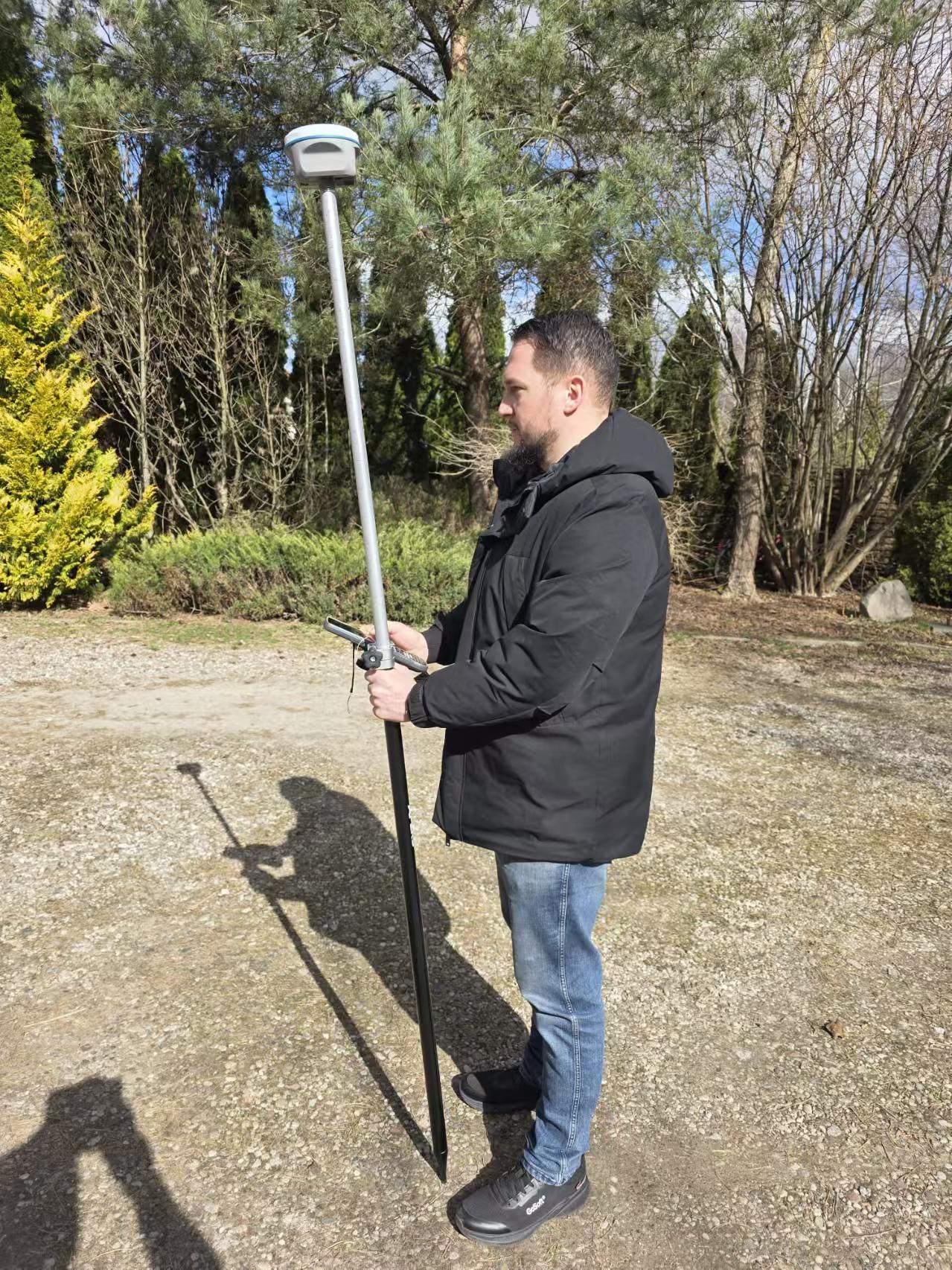
A rover on the pole is the part of an RTK machine you see most — but the fixed solutions come from the base, the corrections link and the receiver working together.
An RTK machine is the field equipment that turns raw satellite signals into centimeter-level coordinates in real time. In surveying it usually means a kit of at least two RTK GNSS receivers — one base and one rover — plus the correction link (UHF radio or NTRIP), a controller and field software. The rover applies the base corrections, fixes carrier-phase ambiguities and outputs a fixed solution on site; on the APEKS AP20AR that is H: 8 mm + 1 ppm RMS horizontal. No post-processing, points verified while you are still standing on them.
What Is an RTK Machine?
Search for an RTK machine and you will find the word used loosely — sometimes for a single receiver, sometimes for a full kit, occasionally for a machine-guidance setup on construction equipment. The precise meaning is this: an RTK machine is a Real-Time Kinematic GNSS positioning system — the hardware set that produces centimeter-level coordinates on site, in real time, without post-processing.
RTK itself is the method, not the box. It works on the carrier phase of the GNSS signal — the same carrier waves your phone ignores — measured simultaneously by two or more receivers. Raw carrier-phase measurements alone contain an unknown integer ambiguity, which is why a single receiver on its own can only deliver meter-level single-point positions. The "machine" earns its centimeter-level accuracy from the combination of receivers, corrections and the processing engine that resolves the ambiguity to a fixed solution.
That is also the practical difference from a handheld GPS unit or a phone. Consumer devices report single-point positions good to a few meters. An RTK survey machine reports a fixed solution at the millimeter-to-centimeter level — the class of accuracy boundary setting, stakeout, topographic survey and machine control all depend on.
How an RTK Machine Works
Every RTK survey machine — from a two-receiver kit to a network rover — runs the same loop:
One nuance worth knowing before you buy: the correction link is not cosmetic. A rover without corrections is just a single-point receiver. The link — radio range, NTRIP coverage, network latency — is part of what defines whether an RTK machine works on your site, and it is the first thing to plan when you design a kit.
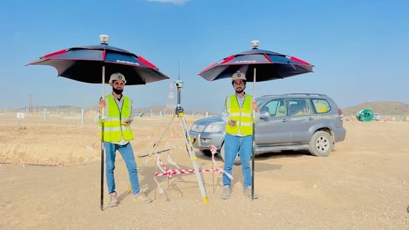
The quiet half of every RTK machine: a base receiver on a known point, broadcasting corrections to every rover on site.
What Is Inside an RTK Survey Machine
A working RTK machine is a system of five parts. When comparing kits, check each one — a kit is only as strong as its weakest link:
| Component | What it does | What to check |
|---|---|---|
| GNSS receiver + antenna | Tracks carrier phase on all constellations; computes the position | Channels, constellations, stated RTK accuracy, initialization time |
| Correction data link | Carries RTCM corrections from base to rover | Internal UHF radio range; 4G/NTRIP support for CORS and VRS |
| Controller + field software | Runs the survey: coordinate systems, stakeout, coding, export | Datum/projection support, CAD import, compatibility with your workflows |
| Pole, tripod, accessories | Holds the antenna at a measured height; levels the base | Bi-pole or GPS pole quality, tribrach, measured-height method |
| Power | Keeps base and rover alive through the shift | Field-replaceable batteries, stated operation time per mode |
The receiver gets the attention, but the correction link and the controller decide how the machine actually behaves in the field.
Types of RTK Machines
"RTK machine" covers a family of configurations. Knowing which one fits your work keeps the kit — and the budget — honest:
Pole rover + base kit. The classic RTK survey machine: one receiver on a pole, one on a tripod over a known point, corrections over radio. This is the configuration for boundary surveys, topographic mapping and construction stakeout — see the AP20 GNSS receiver and the AP20AR with visual AR stakeout as reference configurations.
Handheld RTK receiver. A compact all-in-one unit for GIS, mapping and light-duty stakeout. The APEKS APS1 precision handheld RTK states RTK accuracy of H: 2 cm + 1 ppm / V: 3 cm + 1 ppm — centimeter-level in a pocketable format, trading screen size and radio options for portability.
Dedicated base station. A receiver installed to serve corrections continuously — on a project site for months, or as a private reference for a fleet of rovers. The MAX5 base GNSS receiver is APEKS' dedicated base unit.
RTK machine guidance. The same RTK positions, consumed by a construction machine instead of a surveyor: a receiver feeds blade or bucket control on graders and dozers, so the operator cuts to design without string lines. Our motor grader RTK machine guidance guide walks through that workflow end to end.

The reference configuration: base on the tripod, rover on the pole — one RTK machine, two receivers, one correction link.
How Accurate Is an RTK Machine?
Accuracy claims only mean something in context — next to the other modes the same receiver runs, and with the official qualifiers attached. The table below is the verbatim specification of the APEKS AP20AR, and the pattern it shows is typical for the category:
| Mode | Horizontal | Vertical | When you get the result |
|---|---|---|---|
| Single point | 1.5 m RMS | 2.5 m RMS | Immediately, no corrections |
| DGPS | 0.4 m RMS | 0.8 m RMS | Immediately, code corrections |
| RTK | 8 mm + 1 ppm RMS | 15 mm + 1 ppm RMS | Real time, after initialization (< 5 s typical) |
| PPK | 3 mm + 0.5 ppm RMS | 5 mm + 0.5 ppm RMS | After post-processing |
| Static | 2.5 mm + 0.5 ppm RMS | 5 mm + 0.5 ppm RMS | After observation sessions and processing |
RTK accuracy applies under specified operating conditions, and the "+ 1 ppm" term scales with baseline length — a 10 km baseline adds roughly 1 cm of horizontal error budget over the 8 mm base figure.
RTK vs DGPS, PPK and Static
The same hardware often supports all four modes. What changes is the correction type, the latency and the deliverable:
| Mode | Corrections | Result timing | Typical fit |
|---|---|---|---|
| RTK | Carrier-phase, from base or CORS/VRS | Real time, on site | Stakeout, topographic survey, layout, machine guidance |
| DGPS | Code-based (sub-meter class) | Real time | GIS mapping, navigation-grade positioning |
| PPK | Carrier-phase, logged and processed | After the flight or the survey day | Drone mapping, coverage gaps in the correction link |
| Static | None during observation; long-session processing | Hours to days later | Control networks, reference points, geodetic work |
RTK is the only mode that hands you survey-grade coordinates while you stand on the point — that immediacy is the entire point of an RTK machine.
If you are weighing these modes for a specific deliverable, our explainers go deeper on each: what DGPS is and how it differs from RTK, how post-processed kinematic works, and what a static GNSS survey involves — with a practical static survey field guide for the observation side.
Setting Up an RTK Machine in the Field
The loop below is the daily routine on most RTK survey machines; manufacturer menus differ, the logic does not:
For kit selection once the workflow is clear, the RTK receiver price guide explains what drives the cost differences between configurations — including the subscription side covered in our 3-year RTK cost breakdown.
FAQ
What is an RTK machine in surveying?
An RTK machine is the equipment set that produces centimeter-level coordinates in real time using Real-Time Kinematic GNSS. In practice it means at least two RTK GNSS receivers — a base broadcasting corrections and a rover applying them — plus the correction link (UHF radio or NTRIP), a controller and field software. The rover outputs a fixed solution on site, so points are verified while the crew is still standing on them.
How accurate is an RTK survey machine?
Survey-grade RTK machines state horizontal accuracy around 8 mm + 1 ppm RMS — on the APEKS AP20AR it is H: 8 mm + 1 ppm RMS / V: 15 mm + 1 ppm RMS, with RTK initialization under 5 s typical and reliability over 99.9%. The ppm term scales with the distance between base and rover, and the stated accuracy applies under specified operating conditions. For comparison, the same receiver's DGPS mode is 0.4 m RMS and its static mode is 2.5 mm + 0.5 ppm RMS.
What is the difference between an RTK machine and a DGPS receiver?
DGPS applies code-based corrections and delivers sub-meter accuracy — 0.4 m RMS horizontal on the AP20AR. RTK applies carrier-phase corrections and delivers centimeter-level accuracy — 8 mm + 1 ppm RMS on the same hardware. Both work in real time; the difference is roughly two orders of magnitude in accuracy, which is why boundary work, stakeout and machine control require RTK while GIS mapping can run on DGPS.
Does an RTK machine need a base station?
It needs a correction source, which can be your own base receiver or an external one. A two-receiver kit carries its own base; a single rover can work as a network RTK machine by receiving corrections over the internet from a CORS network or a VRS service via NTRIP. Owning the base costs hardware; using a network costs a subscription and depends on CORS coverage in your area — many crews do both, choosing per project site.
How far can a rover work from its base?
Over the internal UHF radio, the AP20AR states a working range of 8–15 km in ideal environments — real-world range shrinks with terrain, vegetation and interference, which is why repeaters or NTRIP are common on large sites. Over the internet, the rover's working distance is bounded by CORS or VRS coverage and the ppm term of the accuracy specification rather than by radio range, so network RTK scales to whole regions.
NEED AN RTK MACHINE FOR YOUR NEXT PROJECT?
Tell us your site conditions, baselines and deliverables — we will match you to the right base, rover and correction link configuration and send a formal quotation.
Send an Inquiry → WhatsApp Us →About the Author: Marin Hu is a Full-Domain Marketing Expert & Field Engineer at APEKS GNSS, covering GNSS RTK, handheld SLAM LiDAR and total station workflows for international survey projects.