

Scan-to-CAD: From SLAM Point Cloud to DXF and CAD Data
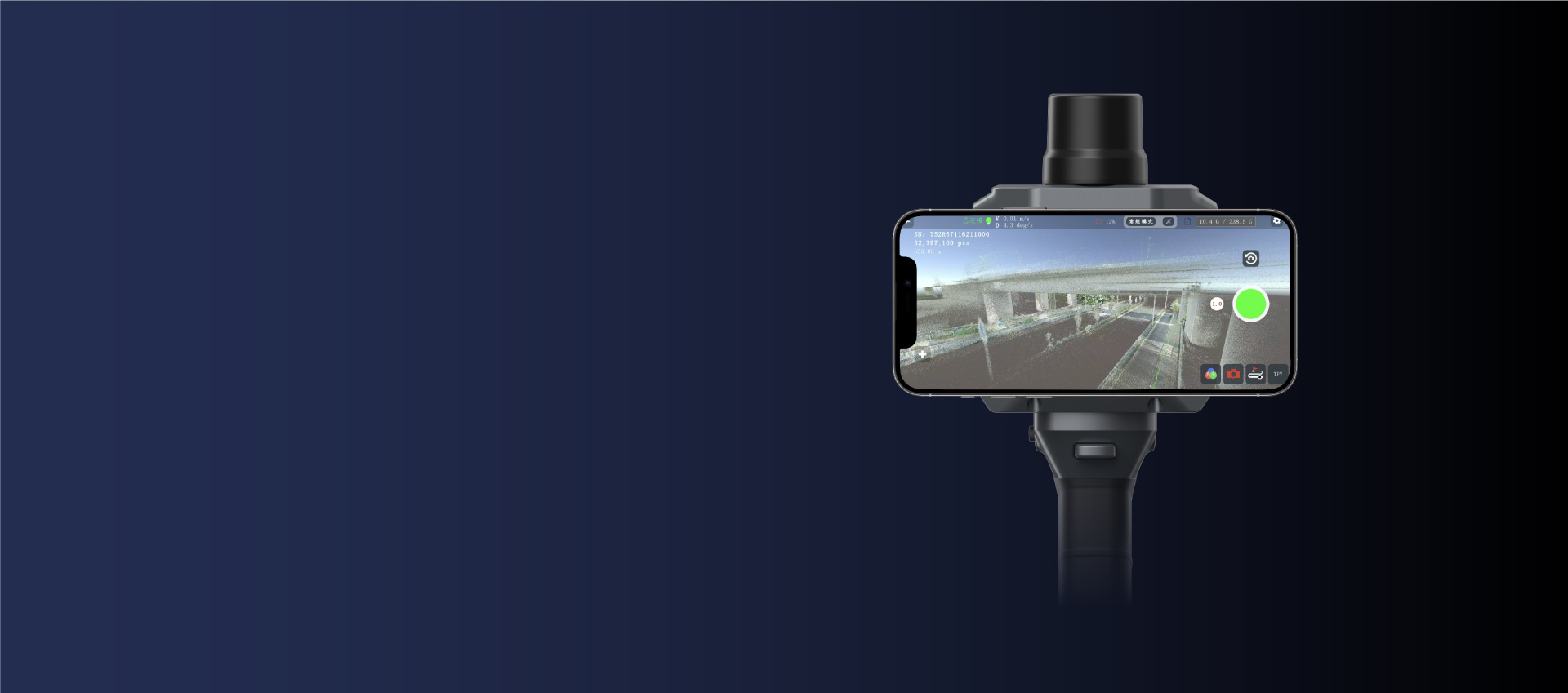
Field capture with real-time point cloud preview — coverage gaps are visible before you leave the site, not after the CAD team asks for them.
Scan-to-CAD means turning a physical site into data a CAD environment can work with — in three steps. Field: capture the site as a continuous colorized point cloud with a handheld SLAM scanner (APEKS-LIVE app shows the cloud building in real time). Office: run trajectory post-processing and final cloud generation in APEKS-CORE. Deliver: export colorized point clouds in LAS, LAZ, E57 or PCD and meshes in PLY; via APEKS-CORE post-processing, additional exports are available, including DXF for CAD, RCP/RCS, SHP, VTK and ASCII formats.
1. What Scan-to-CAD Actually Means
Scan-to-CAD is the workflow of turning an as-built environment into CAD-usable data: a site is captured as a 3D point cloud, the cloud is cleaned and registered, and deliverables are exported into the formats a design team can open — point clouds for measurement and reference, DXF-class data for drafting, meshes for visualization.
What changed with handheld SLAM scanners is the capture step. A tripod-based workflow needs multiple setups and office registration before any CAD work starts; a SLAM scanner produces one continuous, already-registered cloud from a single walk — the handheld SLAM buyer's guide covers the sensor stack behind that. The office steps then become faster too, because the hard part (turning many scans into one cloud) is already done.
Where the workflow earns its keep: as-built drawings of buildings and plant rooms (our building survey and as-built guide walks through that use case), clash checks against design models, and renovation projects where no usable drawings exist.
2. Field Step: Capture Once, Completely
Everything downstream inherits the quality of this step. Four field rules that decide whether the CAD deliverable is usable:
Coverage first. Walk every surface the CAD model will reference — not just the "important" ones. With real-time preview in the APEKS-LIVE app, gaps are visible while you are still on site. On the AScan X1 the LiDAR covers a 360°×59° field of view at up to 200,000 points per second, so a deliberate walk captures far more than the eye does.
Range with conditions. Usable range depends on surface reflectivity: the AScan X1 is specified at 40 m @ 10% reflectivity and 70 m @ 80% reflectivity. Dark or wet surfaces shorten effective range — plan the walk distance accordingly.
Accuracy discipline. Current units specify around 1 cm relative / 5 cm absolute accuracy. Confirm how the manufacturer defines those figures and match them against your drawing tolerances before promising mm-level drafting from scan data.
Coordinates when you need them. If the CAD deliverable must sit in real-world coordinates (site plans, GIS integration), a built-in RTK module anchors the trajectory outdoors — see the built-in RTK explainer for the field logic.
3. Office Step: APEKS-CORE Post-Processing
Back at the desk, the workflow is deliberately short:
Transfer. Pull the project from the built-in 256 GB SSD over USB 3.0.
Process. APEKS-CORE handles the three processing stages: POS processing (trajectory solution), adjustment and refinement, and final point-cloud generation — including colorized point clouds.
Export. Deliver colorized point clouds in LAS, LAZ, E57 or PCD and colorized meshes in PLY. Via APEKS-CORE post-processing, additional exports are available, including DXF for CAD, RCP/RCS, SHP, VTK and ASCII formats (XYZ, PTS, TXT, CSV).
Hand off. CAD teams consume the data in their own environment — drafting from the point cloud, or importing it for reference. The less conversion between the scanner's output and the CAD team's input, the fewer opportunities for quality loss along the way.
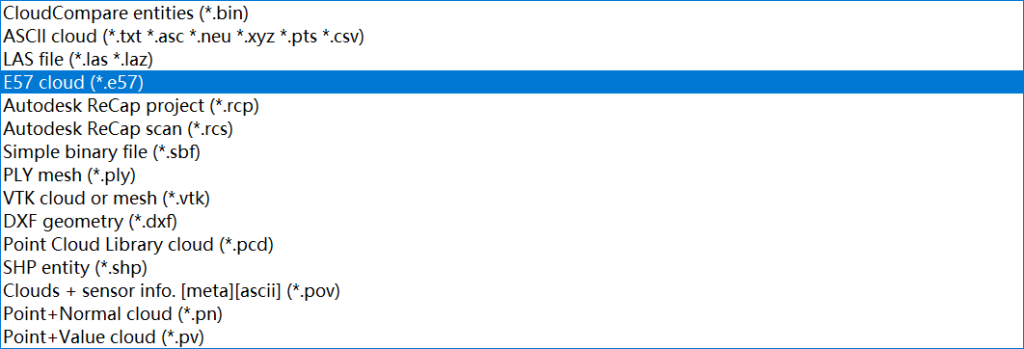
Standard point-cloud formats opening in a third-party viewer — format portability is what keeps your data usable in any downstream tool.
4. Format Guide: Point Cloud to CAD Data
The AScan X1 exports colorized point clouds in LAS, LAZ, E57 and PCD, and meshes in PLY. Choosing between them is a downstream decision:
LAS / LAZ. The de-facto standard for point cloud exchange in survey workflows. LAS is the open format; LAZ is its compressed form — same content, smaller files, ideal for transfer and archiving.
E57. A vendor-neutral container that bundles points with color and metadata — a good deliverable format when the receiver works across different software ecosystems.
PCD. The native format of the Point Cloud Library — common in robotics, automation and research pipelines.
PLY meshes. For visualization, client communication and context — meshes are surfaces, not measurable survey data, so they complement rather than replace the point cloud.
CAD-ready exports. When the drafting team needs vector-friendly data, additional exports are available via APEKS-CORE post-processing — including DXF for CAD, RCP/RCS, SHP, VTK and ASCII formats (XYZ, PTS, TXT, CSV). Confirm the exact list in writing before purchase, and ask the CAD team which format they prefer to receive — that one question prevents most re-export loops.
5. FAQ
Can a CAD program open the point cloud directly?
Many CAD and design environments import standard point cloud formats (LAS, LAZ, E57, PCD) either natively or through their point-cloud modules. For drafting-focused data, DXF-class exports are available via APEKS-CORE post-processing. The practical answer: ask your CAD team which format their workflow prefers, then export to match — the standard format list makes that conversation short.
What format should I deliver to a CAD team?
For measurement and reference work, deliver a colorized point cloud (LAS/LAZ or E57 covers most workflows). For drafting, request or export CAD-friendly data via APEKS-CORE post-processing. Delivering both — cloud for context, CAD data for drafting — is common practice on as-built projects.
Is handheld SLAM accuracy enough for CAD work?
Current units specify around 1 cm relative / 5 cm absolute accuracy — suitable for as-built documentation, area takeoffs and design reference at building scale. Always check how the manufacturer defines its accuracy figures and match them to your drawing tolerances; for high-precision component measurement, a different instrument class applies.
Is the processing software included?
On the AScan X1, yes: the APEKS-LIVE field app and the APEKS-CORE desktop suite are included and permanently activated, covering acquisition control, real-time display, POS processing, adjustment and refinement, point-cloud generation and the export options listed above. Confirm the license model explicitly when comparing any scanner — subscription-based software changes your cost structure every year.
Point cloud or mesh — which do I need?
Both, for different jobs. The point cloud (LAS, LAZ, E57, PCD) is the measurable dataset behind drawings, sections and quantities. The mesh (PLY) is a surface representation for visualization and communication. A scan-to-CAD deliverable usually ships the cloud as the working data and the mesh as the visual companion.
PLANNING A SCAN-TO-CAD WORKFLOW?
Tell us your sites, deliverables and CAD environment — our survey-equipment team will recommend the right configuration and send a formal quotation.
Send an Inquiry → WhatsApp Us →About the Author: Marin Hu is a Full-Domain Marketing Expert & Field Engineer at APEKS GNSS, covering GNSS RTK, handheld SLAM LiDAR and total station workflows for international survey projects.