

APEKS RTK GNSS in Nigeria: Field Training & Boundary Survey
A local survey team in Nigeria deployed the APEKS RTK GNSS base and rover system for land boundary mapping, combining real fieldwork with hands-on training on the ApekSurv controller interface. The deployment covered core RTK workflow elements — base station setup, rover operation with a survey sunshade umbrella for all-day continuity, and controller-based coordinate review — giving the field team practical, on-site experience beyond equipment manuals alone.
1. The Deployment: Base+Rover for Land Boundary Survey
A surveying crew in Nigeria deployed a complete APEKS RTK GNSS base and rover system to conduct a multi-point cadastral and land boundary mapping project. Operating in tropical coastal environments presents unique fieldwork challenges, requiring robust hardware resilience, clean radio transmission, and reliable battery endurance.
The field deployment integrated standard geodetic procedures: establishing an autonomous base station over an established site benchmark, configuring real-time differential data transmission, and executing parcel boundary collection using an RTK rover pole. Rather than relying on classroom theory or digital documentation alone, this project emphasized practical, on-site competency building to ensure the local team could independently manage daily setup, coordinate localization, and field data quality control.
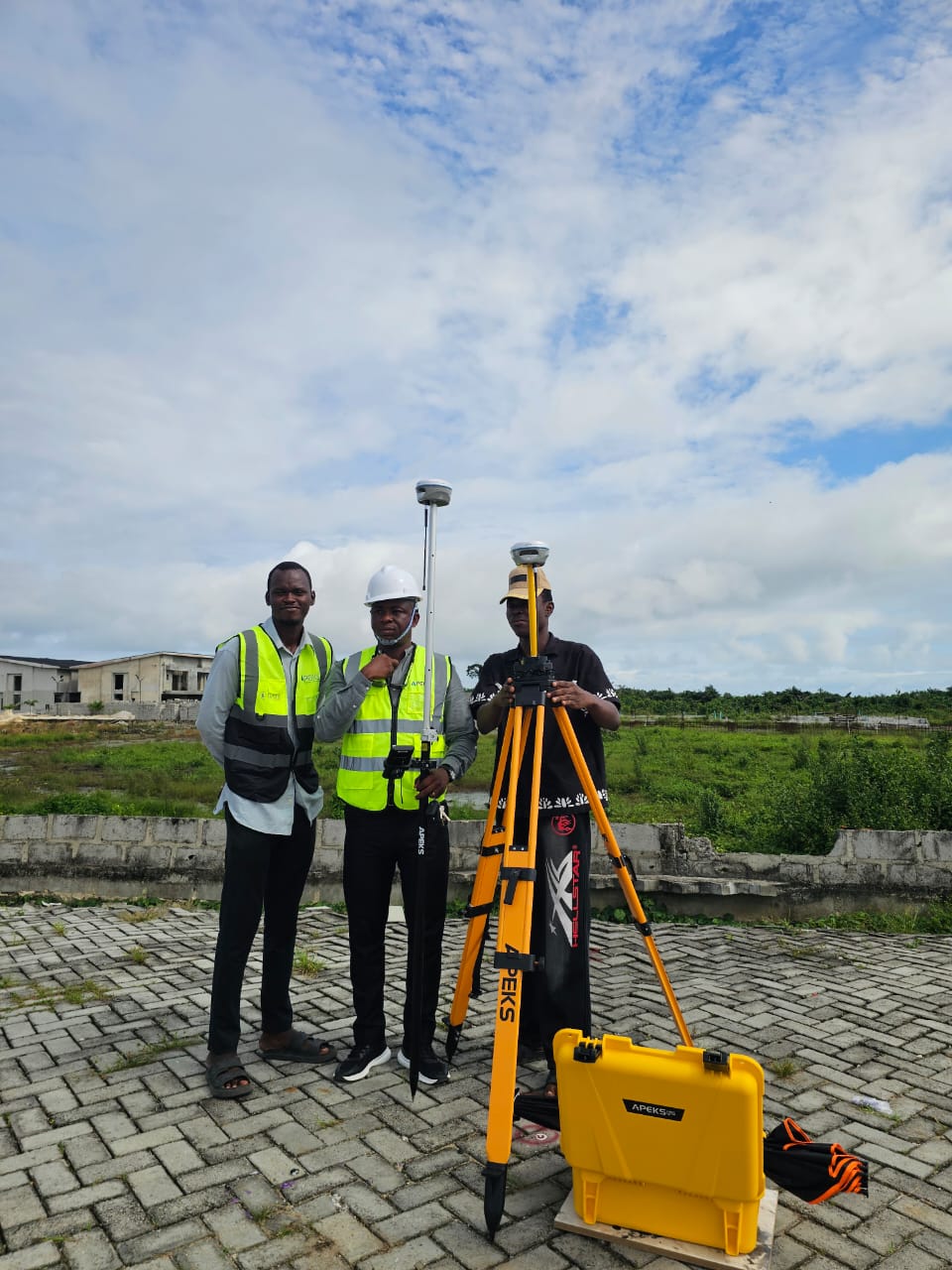
2. Scene A: Full Team Setup in the Field
The full survey team is shown here with the complete APEKS Base and Rover system deployed for a land boundary mapping project in Nigeria — base station and rover units set up together as part of the day's fieldwork.
3. Scene B: Survey Pole and Umbrella for All-Day Fieldwork
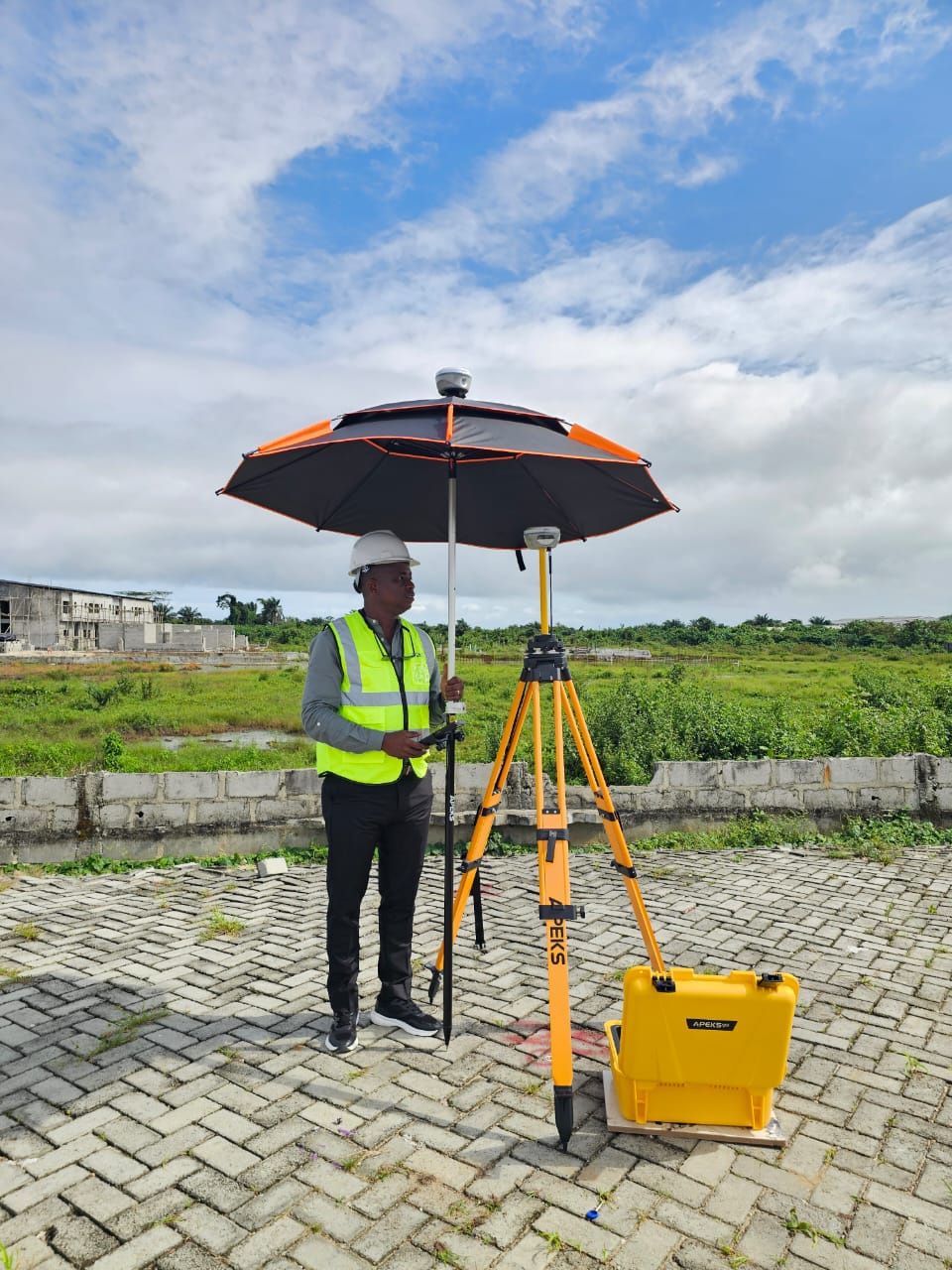
A surveyor operates the APEKS RTK rover equipped with a protective survey sunshade umbrella, working alongside a tripod-mounted base station. The umbrella setup — the same approach used during high-temperature fieldwork in Oman (see our Oman Solar Survey Case Study) — helps maintain operator comfort and equipment stability during extended outdoor sessions.
Direct equatorial sun and sudden tropical downpours can challenge touchscreen readability and cause electronic thermal throttling. Integrating a rugged, high-visibility survey sunshade onto the carbon fiber rover rod protects the field controller and receiver from thermal buildup while keeping screen glare minimal during long observation sessions.
4. Scene C: On-Site Controller Training
Field surveyors review coordinate data together on an APEKS rugged controller during an on-site RTK training session — a hands-on approach that helps teams build practical confidence with the ApekSurv software beyond what a manual alone can teach.
Effective equipment deployment requires practical confidence in the software interface. During this hands-on session, the crew practiced initializing RTK Fixed solutions, verifying base-rover communication integrity, setting feature codes, and inspecting horizontal and vertical RMS values in real time. For more on this philosophy, see our dedicated guide on Why RTK GNSS Field Training Matters.
5. Scene D: Close-Up — ApekSurv in Action
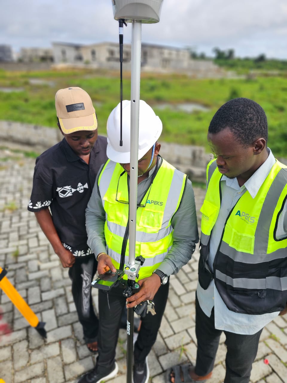
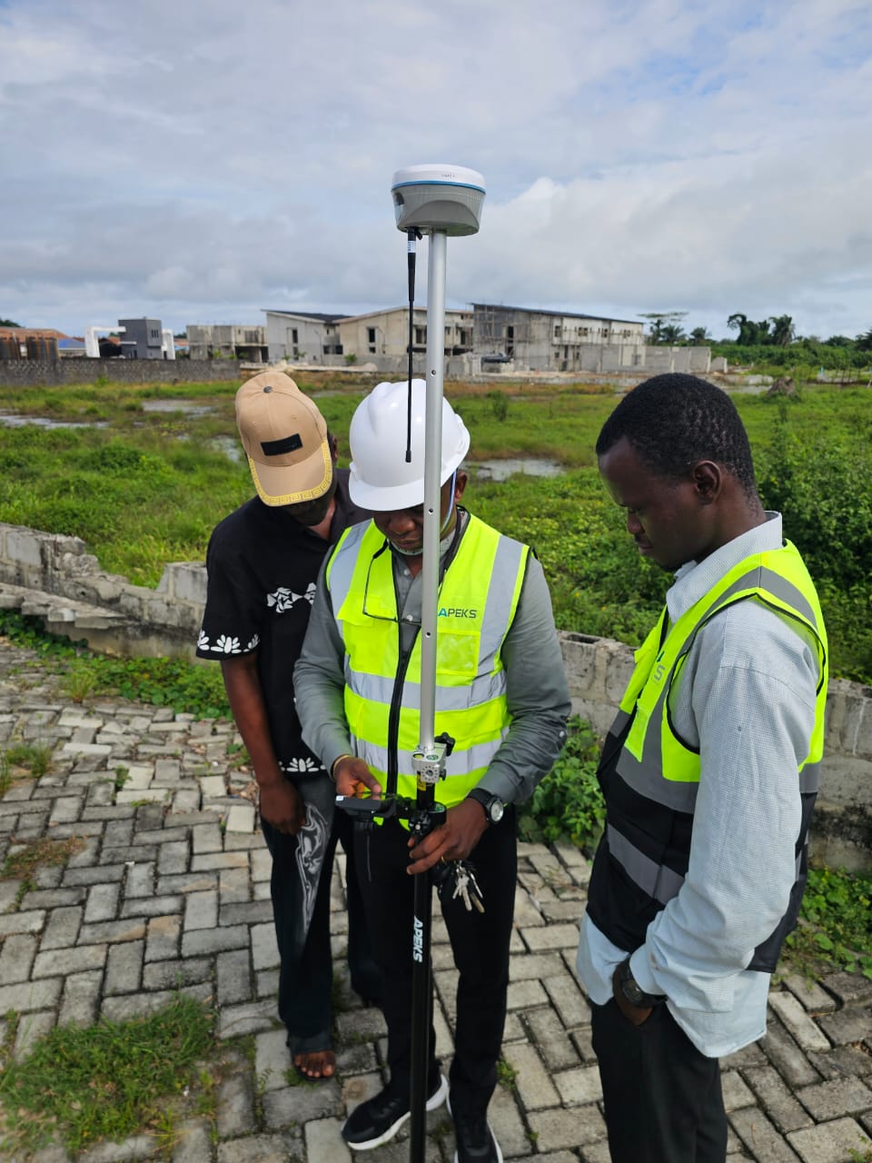
A close-up view of engineers operating the ApekSurv field software on an APEKS handheld controller, mounted directly on the RTK rover pole — showing the practical interface surveyors interact with throughout a boundary mapping session.
The field controller bracket keeps the sunlight-readable display directly in the operator's line of sight. Within ApekSurv, surveyors execute boundary point logging, point stakeout navigation, and background base-map CAD overlays, verifying instant centimeter-level fix status before storing each boundary vector.
6. Why Field Training Matters in Practice
This deployment highlights that technology adoption and human capability building are deeply interconnected. Rather than separating equipment handover from project work, conducting structured training directly on an active project site allows survey teams to resolve practical challenges immediately — such as verifying local coordinate transformations and managing radio baselines under real field conditions.
For surveying and engineering firms in developing infrastructure markets, hands-on field instruction creates long-term operational autonomy. Teams develop instinctive familiarity with the instruments, avoid common data logging pitfalls, and ensure that every cadastral survey delivered to clients complies with national geodetic standards. For technical reference on national datums, coordinate projections, and local base configurations, explore our comprehensive Nigeria GNSS RTK & CORS Survey Guide.
7. FAQ
What equipment is shown in this Nigeria field deployment?
The deployment features a complete APEKS RTK GNSS system, including a base station receiver mounted on an aluminum survey tripod, an RTK rover receiver mounted on a range pole with a protective survey umbrella, an APEKS rugged field controller running ApekSurv software, and a durable hard carry case.
Why is field training important when adopting new RTK GNSS equipment?
Hands-on field training bridges the gap between theoretical manuals and real-world surveying. On-site guidance helps surveyors master base station setup, coordinate system localization, radio link diagnostics, and real-time accuracy checks under genuine environmental conditions.
What is the survey umbrella used for in RTK fieldwork?
A survey umbrella attaches directly to the rover pole to shield the field controller and receiver from direct tropical solar heat and sudden rain showers. It reduces screen glare for the operator and prevents thermal throttling of electronic equipment during all-day field campaigns.
Does APEKS provide field training support in Nigeria?
Yes. APEKS works closely with local partners and technical specialists across West Africa to deliver practical on-site commissioning, software training, and ongoing technical support for cadastral, infrastructure, and mining surveying teams.
REAL FIELDWORK. REAL TRAINING. REAL RESULTS.
APEKS RTK GNSS base and rover systems, deployed and taught hands-on in the field — from Nigeria to markets worldwide. Equipment that comes with real support.